


0710022 - TYTY Voting District, Colquitt County, Georgia
About
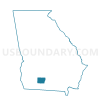
Outline

Summary
| Unique Area Identifier | 560943 |
| Name | 0710022 - TYTY Voting District |
| County | Colquitt County |
| State | Georgia |
| Area (square miles) | 31.36 |
| Land Area (square miles) | 30.23 |
| Water Area (square miles) | 1.12 |
| % of Land Area | 96.42 |
| % of Water Area | 3.58 |
| Latitude of the Internal Point | 31.28795850 |
| Longtitude of the Internal Point | -83.56034260 |
Maps


Graphs
Select a template below for downloading or customizing gragh for 0710022 - TYTY Voting District, Colquitt County, Georgia


Neighbors
Neighoring Voting District (by Name) Neighboring Voting District on the Map
- 0710009 - CROSLAND Voting District, Colquitt County, GA
- 0710023 - WARRIOR Voting District, Colquitt County, GA
- 075L - LENOX Voting District, Cook County, GA
- 27706 - ELDORADO Voting District, Tift County, GA
- 27707 - OMEGA Voting District, Tift County, GA
Top 10 Neighboring County Subdivision (by Population) Neighboring County Subdivision on the Map
- Norman Park CCD, Colquitt County, GA (5,188)
- Berlin-Ellenton CCD, Colquitt County, GA (3,449)
- Omega CCD, Tift County, GA (2,435)
- Lenox CCD, Cook County, GA (2,151)
Top 10 Neighboring Place (by Population) Neighboring Place on the Map
Top 10 Neighboring Unified School District (by Population) Neighboring Unified School District on the Map
- Colquitt County School District, GA (45,498)
- Tift County School District, GA (40,118)
- Cook County School District, GA (17,212)
Top 10 Neighboring State Legislative District Lower Chamber (by Population) Neighboring State Legislative District Lower Chamber on the Map
Top 10 Neighboring State Legislative District Upper Chamber (by Population) Neighboring State Legislative District Upper Chamber on the Map
- State Senate District 7, GA (162,770)
- State Senate District 13, GA (150,866)
- State Senate District 11, GA (149,726)
Top 10 Neighboring 111th Congressional District (by Population) Neighboring 111th Congressional District on the Map
Top 10 Neighboring Census Tract (by Population) Neighboring Census Tract on the Map
- Census Tract 9701, Colquitt County, GA (5,184)
- Census Tract 9705, Colquitt County, GA (3,449)
- Census Tract 9608, Tift County, GA (2,435)
- Census Tract 9601, Cook County, GA (2,151)